測繪記錄本/水準儀.經緯儀野外測量記錄本質量保證杭州實體店
測繪記錄本/水準儀、經緯儀野外測量記錄本介紹
中文介紹
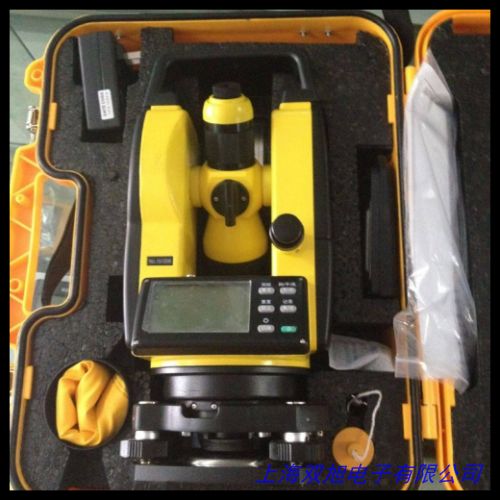
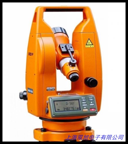
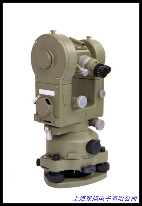
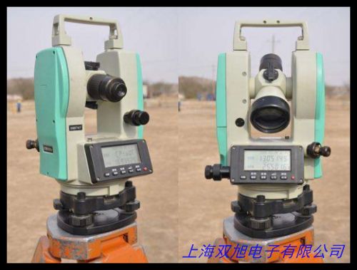
在測繪領域,記錄本是野外測量工作不可或缺的重要工具。我們?yōu)槟拇蛟斓臏y繪記錄本,專為水準儀、經緯儀等測量設備的野外作業(yè)場景設計,充分滿足測繪人員在復雜環(huán)境下的記錄需求。
采用高品質的紙張,具有良好的耐水、耐污性能,即使在潮濕或泥濘的野外環(huán)境中,也能確保記錄內容清晰可辨,不會因受潮或沾染污漬而模糊不清,有效保障記錄的完整性和準確性。封面堅固耐用,能夠抵御一定程度的刮擦和碰撞,保護記錄本內部的紙張不受損壞,延長使用壽命。
記錄本的版面設計科學合理,針對水準儀和經緯儀測量的常見數(shù)據(jù)類型,設置了專門的記錄欄目,如測量點編號、高程、角度、距離等,方便測繪人員快速準確地填寫數(shù)據(jù),減少因查找或自行繪制表格而浪費的時間,提高工作效率。同時,預留了足夠的空白區(qū)域,供測繪人員記錄額外的觀測情況、備注信息或進行簡單的計算,滿足多樣化的記錄需求。
尺寸適中,便于攜帶,測繪人員可以輕松將其放入工具包或口袋中,隨時隨地進行記錄,不會給野外作業(yè)帶來額外的負擔。無論是進行城市規(guī)劃測量、地形測繪,還是工程建筑施工測量等各類測繪任務,這款測繪記錄本都能為您提供可靠的記錄支持,是您野外測量工作中的得力助手。
English Introduction
In the field of surveying, a record book is an essential tool for field measurement work. We have carefully designed a surveying record book specifically for field operations with measuring instruments such as levels and theodolites, fully meeting the recording needs of surveyors in complex environments.
The high-quality paper used in the record book has good water and stain resistance. Even in damp or muddy field conditions, it can ensure that the recorded content remains clear and legible, without becoming blurred due to moisture or dirt, effectively ensuring the integrity and accuracy of the records. The durable cover can withstand a certain degree of scratches and impacts, protecting the paper inside the record book from damage and extending its service life.
The layout of the record book is scientifically and reasonably designed. It features specialized columns for recording common data types from level and theodolite measurements, such as measurement point numbers, elevations, angles, and distances. This allows surveyors to quickly and accurately fill in data, reducing the time wasted in searching for or manually drawing tables and improving work efficiency. At the same time, there is ample blank space reserved for surveyors to record additional observations, notes, or perform simple calculations, meeting a variety of recording needs.
The size of the record book is moderate and easy to carry. Surveyors can easily put it into their tool bag or pocket, allowing them to record information anytime and anywhere without adding extra burden to field operations. Whether for urban planning surveys, topographic mapping, or construction engineering surveys and other types of surveying tasks, this surveying record book can provide reliable recording support and is an indispensable assistant for your field measurement work.
測繪記錄本/水準儀.經緯儀野外測量記錄本質量保證杭州實體店

瑞士 自動線圈密度測量儀,自動經緯密度分析儀 pick counter,高品質8x35mm圓柱水平泡 水平儀水準泡 水平珠,電子經緯儀上下激光經緯儀DE2A系列,相機水平泡 相機水平儀 單反相機熱靴水準泡,垂準儀激光靶牌 激光經緯儀靶 黃色 300*300。承裝承修承試電力設施許可證用 所需施工機具 經緯儀,英國Vector高精度風速傳感器A100L2,國產通用全站儀/電子經緯儀充電器 充電器 充電速度快,冰河610戶外手持GPS導航北斗雙星經緯度定位儀海拔面積,TESA 螺釘固定式水平儀。科力達經緯儀/電子經緯儀DT-02CL/DT-02LL經緯儀,路燈時間控制器-經緯時控儀 CH09-A 六路時控開關,紡織儀器Y511C型織物經緯密度鏡片,各種迷你型水平儀HD-MN07。激光經緯羅盤儀 激光經緯羅盤儀,科技 DT-02CL 經緯儀 上下激光 高精度測量儀 ,CH09系列時控開關生產 經緯時控儀 歡迎,10X型三折式經緯密度的觀察和分析放大鏡,蘇州一光LT402L上下激光電子經緯儀DT402L激光對點。
上一篇 手持式GPS定位器 電子羅盤尋路寶 經緯度海拔 戶外旅游必備 http://www.uoncy.cn/product/d122674.html
|