北京博飛J2經(jīng)緯儀產(chǎn)品介紹
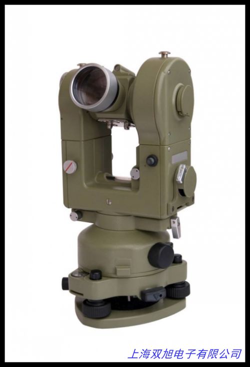
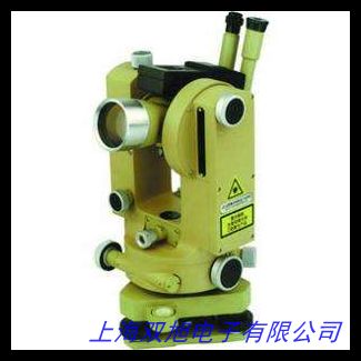
北京博飛J2經(jīng)緯儀是一款適用于工程測量、地形測繪及施工放樣的精密光學(xué)儀器。該產(chǎn)品秉承嚴(yán)謹(jǐn)?shù)墓に囋O(shè)計理念,以穩(wěn)定可靠的性能滿足多種場景下的角度測量需求。儀器采用優(yōu)質(zhì)光學(xué)玻璃鏡片組,配合精密機械結(jié)構(gòu),確保觀測數(shù)據(jù)的清晰度與準(zhǔn)確性。其人性化操作界面和輕量化機身設(shè)計,能夠有效提升野外作業(yè)效率。
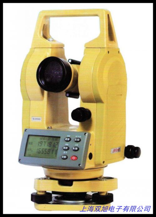
產(chǎn)品配備高精度軸系系統(tǒng),通過優(yōu)化傳動結(jié)構(gòu)減少機械誤差,保證水平角與垂直角測量的長期穩(wěn)定性。望遠(yuǎn)鏡系統(tǒng)提供30倍有效放大倍率,配合全封閉式光學(xué)對中器,可在復(fù)雜光線條件下快速完成對中整平。儀器配備雙向補償器,能夠自動修正微小傾角誤差,進一步提升測量結(jié)果的可靠性。為適應(yīng)不同環(huán)境需求,產(chǎn)品采用防塵防水結(jié)構(gòu)設(shè)計,關(guān)鍵部件經(jīng)過特殊工藝處理,在-20℃至+50℃溫度范圍內(nèi)均可保持穩(wěn)定工作狀態(tài)。
本溪測繪儀器系列產(chǎn)品注重實用性與耐用性的結(jié)合,配備可拆卸式基座與模塊化功能組件,便于維護保養(yǎng)與功能擴展。儀器標(biāo)配可充電鋰電池組,支持連續(xù)8小時作業(yè)續(xù)航,并配備低功耗提示功能。操作界面采用雙面液晶顯示屏,支持角度單位切換與數(shù)據(jù)保持功能,滿足多樣化測量需求。
該系列產(chǎn)品適用于土木工程、水利建設(shè)、礦山測量及地質(zhì)勘探等領(lǐng)域,其緊湊型結(jié)構(gòu)設(shè)計兼顧室內(nèi)外作業(yè)需求。通過優(yōu)化光學(xué)路徑與機械配合公差,在保證測量精度的同時,實現(xiàn)更便捷的攜帶與操作體驗。
Technical Specifications:
Angular Accuracy: ±2"
Telescope Magnification: 30×
Effective Aperture: 40mm
Field of View: 1°30
Shortest Sighting Distance: 1.5m
Level Sensitivity: 30"/2mm
Working Temperature Range: -20℃ to +50℃
Instrument Height: 280mm
Total Weight: 4.8kg
Beijing Boof Surveying Instrument J2 Theodolite is designed for engineering surveying and construction layout applications. The instrument integrates precision optical system with ergonomic mechanical structure, delivering reliable angle measurement performance in various working conditions. Featuring 30× magnification telescope and enclosed optical plummet, it ensures fast setup and accurate targeting even under challenging lighting conditions.
The dual-axis compensation system effectively corrects residual leveling errors within ±3 range. Robust construction with dust-proof and moisture-resistant design guarantees stable operation in harsh environments. Modular components allow flexible configuration according to specific project requirements. Rechargeable battery provides extended field operation time with power-saving indicators for energy management.
This theodolite series demonstrates balanced performance in measurement accuracy and operational efficiency, making it suitable for construction sites, infrastructure projects and topographic surveys. Optimized optical path design enhances image clarity while maintaining compact dimensions for easy transportation. Intuitive dual-side display interface supports multiple angle units and data hold function, streamlining field operations for survey professionals.